Maps & Locations
Last verified: Sep 5, 2026 · Pre-launch edition (updated Sep 8)
Halloween: The Game launches with four unique multiplayer maps that rebuild Haddonfield around the landmarks of the 1978 film — the Myers house, the Strode residence, Nichols Hardware and more — then extend outward into a whole town. This map guide breaks down every confirmed location, what IllFonic says about each one, and how the geography shapes play for Michael and the Heroes of Haddonfield.
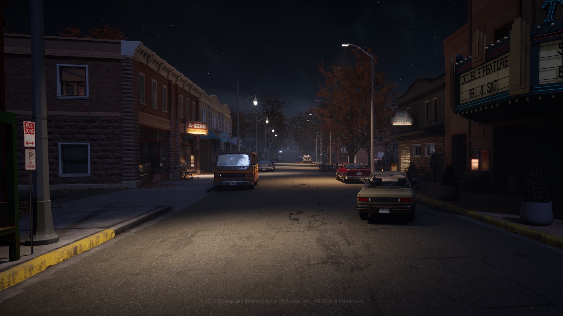
01THE FOUR LAUNCH MAPS
| Map | Character | Signature landmarks |
|---|---|---|
| Haddonfield Town Center | The downtown cultural and economic hub | Nichols Hardware, A-Side Music Store, Hill Garden Center, Patty's Pub |
| Haddonfield Heights | The family neighborhood with a dark history | Strode house, the Myers house on Lampkin Lane, the water tower |
| Orange Grove Estates | The upscale suburb | Wallace residence, Doyle house, neighborhood park |
| East Haddonfield | The rural outskirts | The Rabbit in Red Lounge, Phelps Garage, Midwest Feed Co. |
IllFonic's art team began with film locations — the Myers' House, Nichols Hardware, the Strode residence — "as starting points, and then constructed an entire town around them." Art director Cole Gray describes the process: "our creative process began with the original film locations serving as our primary 'ignition point.' From there, we extended outward… into a cohesive, atmospheric Midwest town."
02HADDONFIELD TOWN CENTER
The bustling heart of Haddonfield and the map where Michael "completes his transformation into the Boogeyman" in the film. Officially described as the town's cultural and economic hub, packed with anchor shops and local watering holes:
- Nichols Hardware — the one-stop shop: axes, first aid kits, tools, "and due to high demand, Halloween masks are now in stock." Prime loot ground for heroes and a landmark-heavy interior for Michael.
- A-Side Music Store — the town's sonic headquarters, full of records and instruments (and hiding spots between the shelves).
- Hill Garden Center — landscaping equipment, trees and decor with interactive outdoor displays.
- Patty's Pub — pool tables, a jukebox, open until 2 AM, with a conveniently placed pay phone out front — a reliable spot for heroes to call the police.
- Post Office, Margie's Auto Repair and the cemetery — the full-service town extras; the cemetery's winding paths are where Rachel Calahan indulges her hobbies.
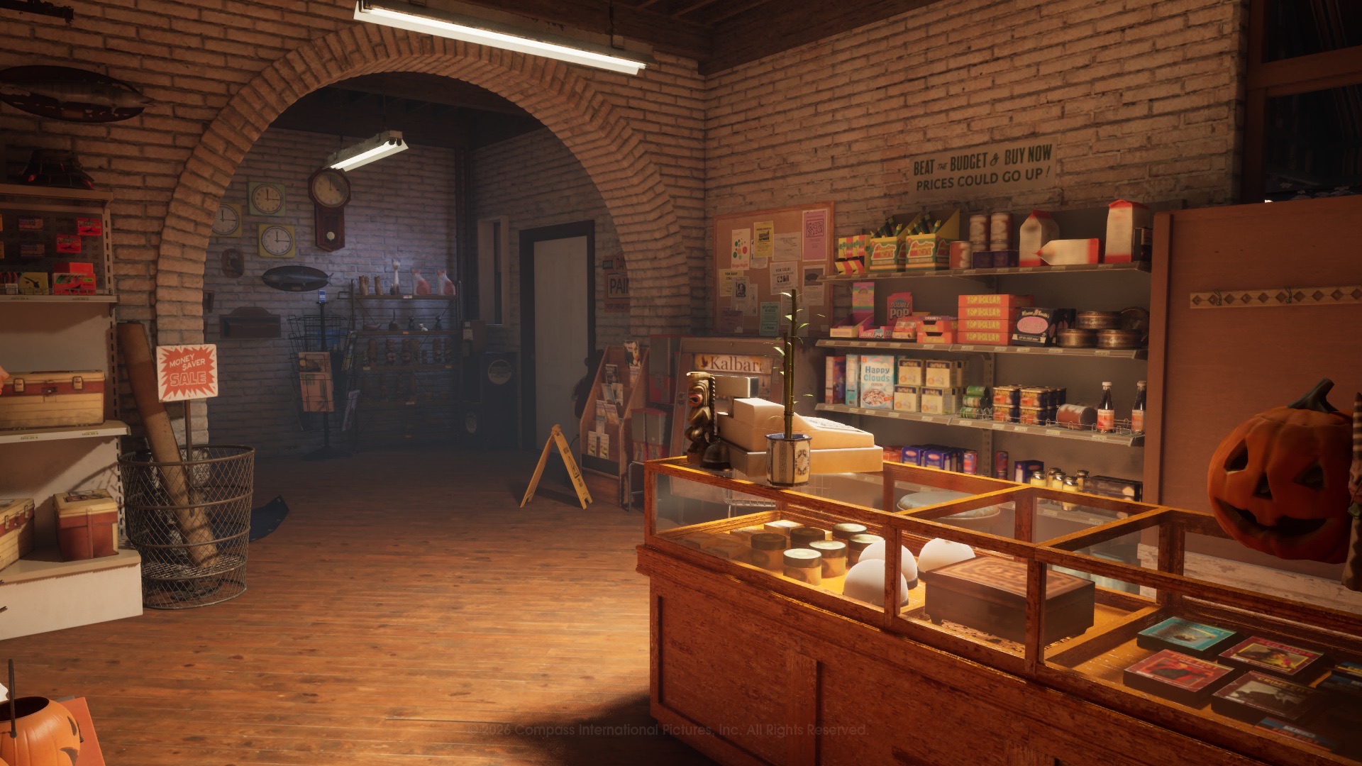
Play notes: the densest map for interiors, which favors Michael's Shape Jump between rooms and gives heroes many containers, phones and hiding places. Street crossings between shops are the exposed moments — heroes should treat them as the risky part of the route.
03HADDONFIELD HEIGHTS
The horrors that occurred on Halloween night in 1963 "echoed through the streets of Haddonfield Heights. Now 15 years later, the nightmare has returned." This quaint, family-friendly neighborhood is home to the two most famous houses in horror:
- The Strode house — where Laurie Strode lives; the film's anchor residence.
- The Myers house on Lampkin Lane — abandoned and allegedly haunted, where Michael murdered his sister Judith in 1963 and tragedy struck the town.
- The water tower — an enormous landmark looming over the quiet streets; residents gather there to share the twisted tale of Lampkin Lane.
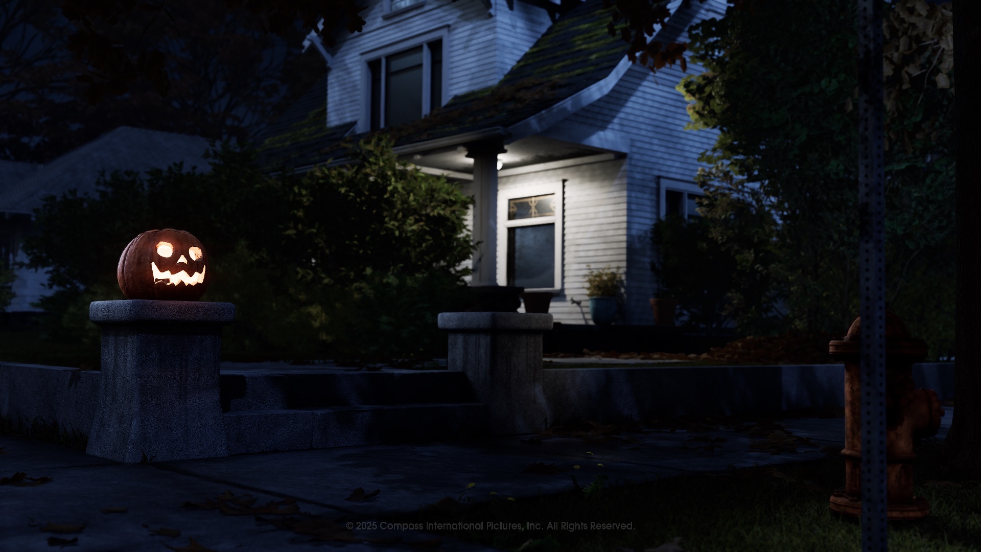
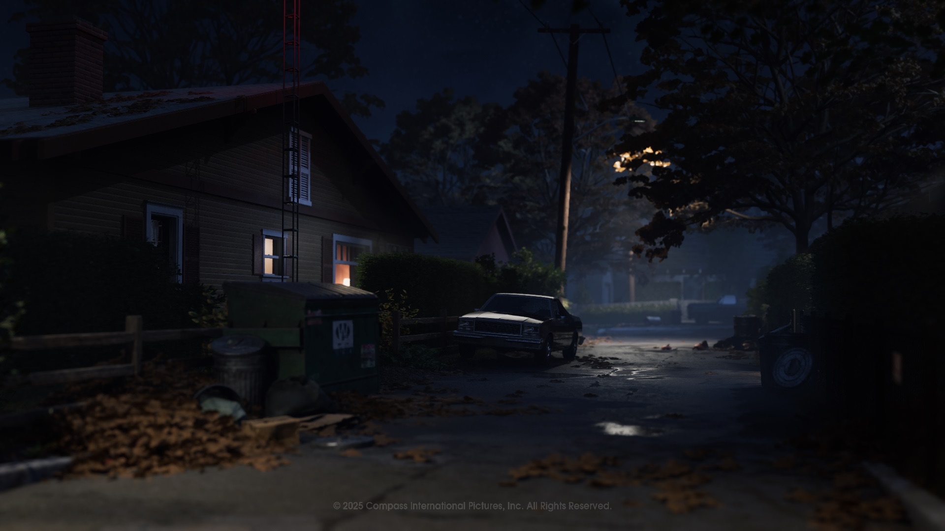
Play notes: the most film-faithful map for roleplay, with the Myers house acting as a natural landmark for navigation. Long residential sightlines help Michael track movement, while the large house interiors give heroes plenty of fallback hiding places.
04ORANGE GROVE ESTATES
Even the safest, most picturesque communities aren't safe from pure evil. Orange Grove Estates is the upscale Haddonfield suburb where families dream of forever homes — and where two film landmarks sit across the street from each other:
- The Wallace residence — where Annie Brackett regularly babysits. Recreated with a backyard shed to explore and multiple rooms to terrorize.
- The Doyle house — where Laurie Strode offers her babysitting expertise. Multi-story with multiple points of entry; official copy advises locking the doors.
- The neighborhood park — playground, basketball court, picnic areas and winding paths; useful temporary barriers, but one slip on the merry-go-round can be fatal.
Lead designer Jordan Mathewson warns that the large multi-story homes create "precarious and tense upper-level gameplay" — second-story balconies are escape options and death traps in equal measure. Learn the staircases before you need them.
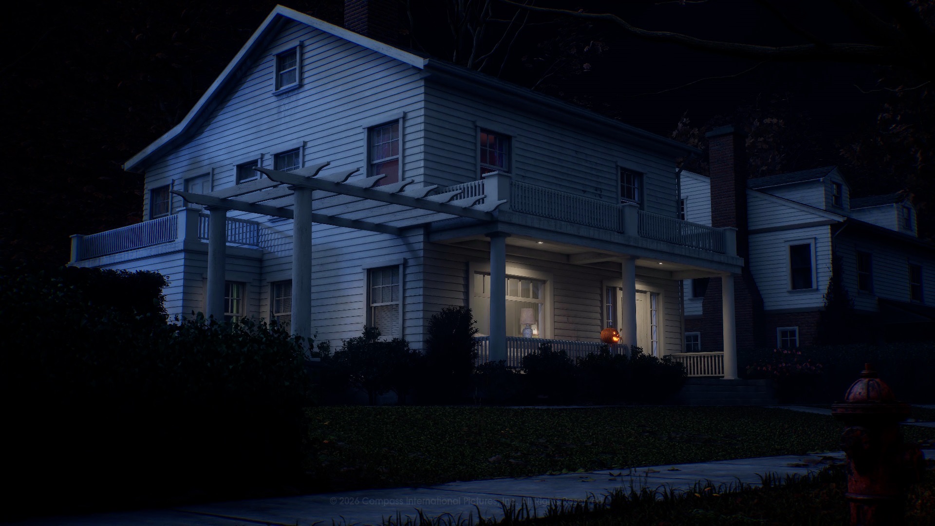
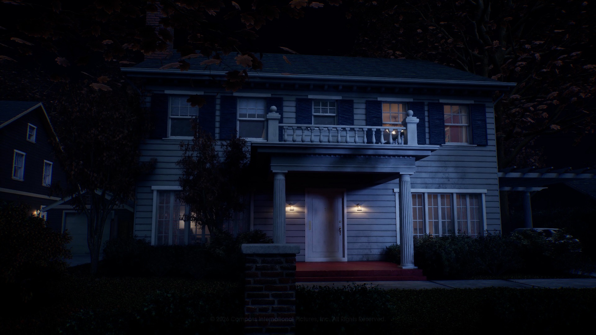
Play notes: fences and hedges block escape paths and create stressful chokepoints; open streets suit repaired vehicles and bikes. Michael can use the wide sightlines to stalk from afar, while heroes can use the park obstacles to break chase — if they don't trip on the merry-go-round.
05EAST HADDONFIELD
The rural outskirts where Michael's journey home begins: "On the outskirts of town, he enters East Haddonfield." A rustic agricultural hub with farmland and a reputation:
- The Rabbit in Red Lounge — a rowdy, leather-clad biker bar that's "seen its fair share of broken beer bottles and bareknuckle brawls," home turf of the Castle Hill Rooks biker gang.
- Phelps Garage — automotive services and the best gas prices around; the garage plays a story role in the singleplayer campaign too.
- Midwest Feed Company — the area's economic anchor and a major local employer.
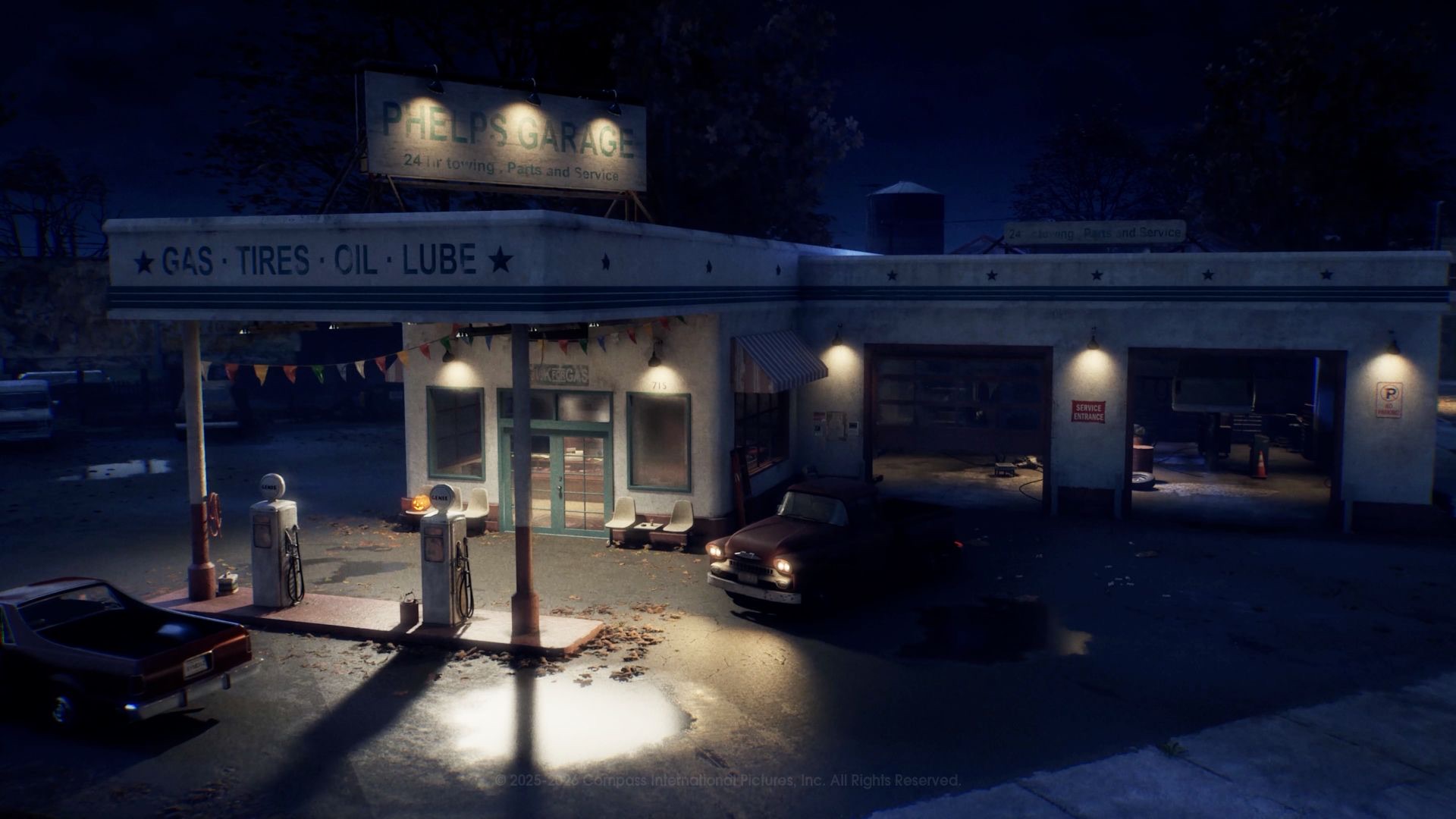
Play notes: the most open map — fewer interiors, more farmland and road. Vehicle and bike play matters most here; heroes should treat the Lounge and Garage interiors as the main loot and phone anchors, while Michael works the open ground between them with Shape Dash.
06MAP STRATEGY SUMMARY
| Map | For Michael | For Heroes |
|---|---|---|
| Town Center | Hunt interiors; cut shop lights; ambush street crossings | Rich loot + pay phones; move between buildings in pairs |
| Heights | Use sightlines to track; pressure the two landmark houses | Hiding places in large homes; watch Lampkin Lane |
| Orange Grove | Chokepoints at fences/hedges; second-floor plays | Vehicles on wide streets; park obstacles to break chase |
| East Haddonfield | Control the two interiors; intercept open-ground runs | Garage and bar loot; bike/vehicle advantage |
Remember: escape routes and key item spawns are randomized each match, but the landmarks above are permanent. Learn where the phones, containers and hiding places cluster by interior, and the random element shrinks fast.
Map FAQ
How many maps does Halloween: The Game have?
Four multiplayer maps at launch: Haddonfield Town Center, Haddonfield Heights, Orange Grove Estates and East Haddonfield. The singleplayer campaign adds its own story locations.
Is the Myers house in the game?
Yes — the abandoned Myers house on Lampkin Lane is a landmark in Haddonfield Heights, faithfully rebuilt from the 1978 film.
Is Laurie Strode's house in the game?
Yes. The Strode house sits in Haddonfield Heights, and the Doyle house (where Laurie babysits) is in Orange Grove Estates.
Do maps change between matches?
The geography is fixed but the sandbox is dynamic: item spawns, lootable containers and possible escape routes are randomized, and players can alter lighting and power during a match.
Will there be more maps after launch?
IllFonic hasn't announced post-launch maps yet. This page will list them the moment official news lands.